Ten Scenic Day hikes in New Zealand’s South Island that you shouldn’t miss

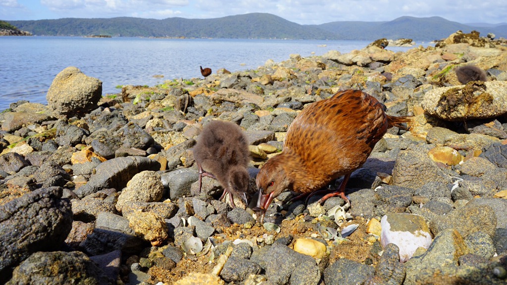
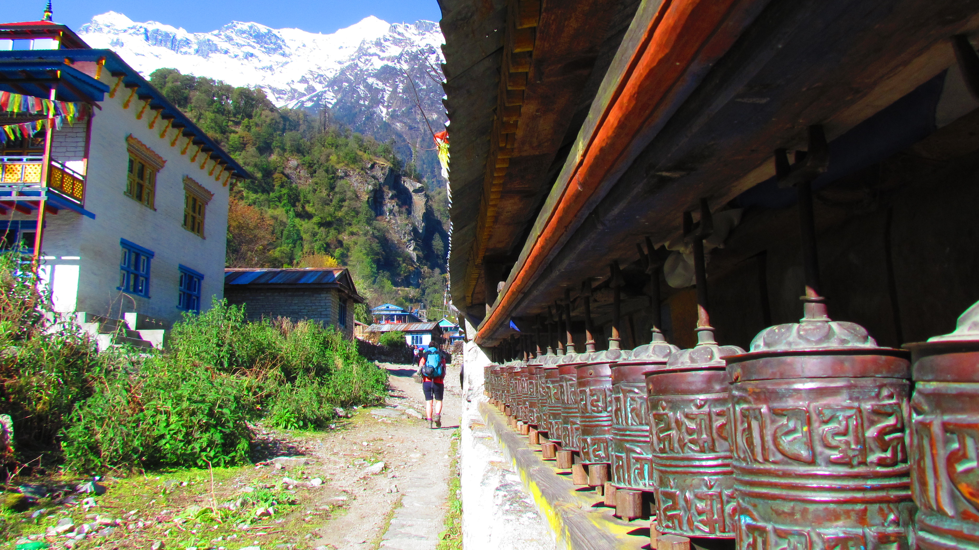
New Zealand is famed for its picturesque landscapes, soaring mountains, untouched wilderness and of cause it’s ‘Great Walks’. But if your don’t have the time, money, gear, or simply the will to trek day after day with a heavy pack on your back… why not instead get your boots out and stretch those legs of yours on one of New Zealand’s beautiful days walks? It would pretty much be a crime not to! So, in no particular order, here’s our top pick for the South Island….

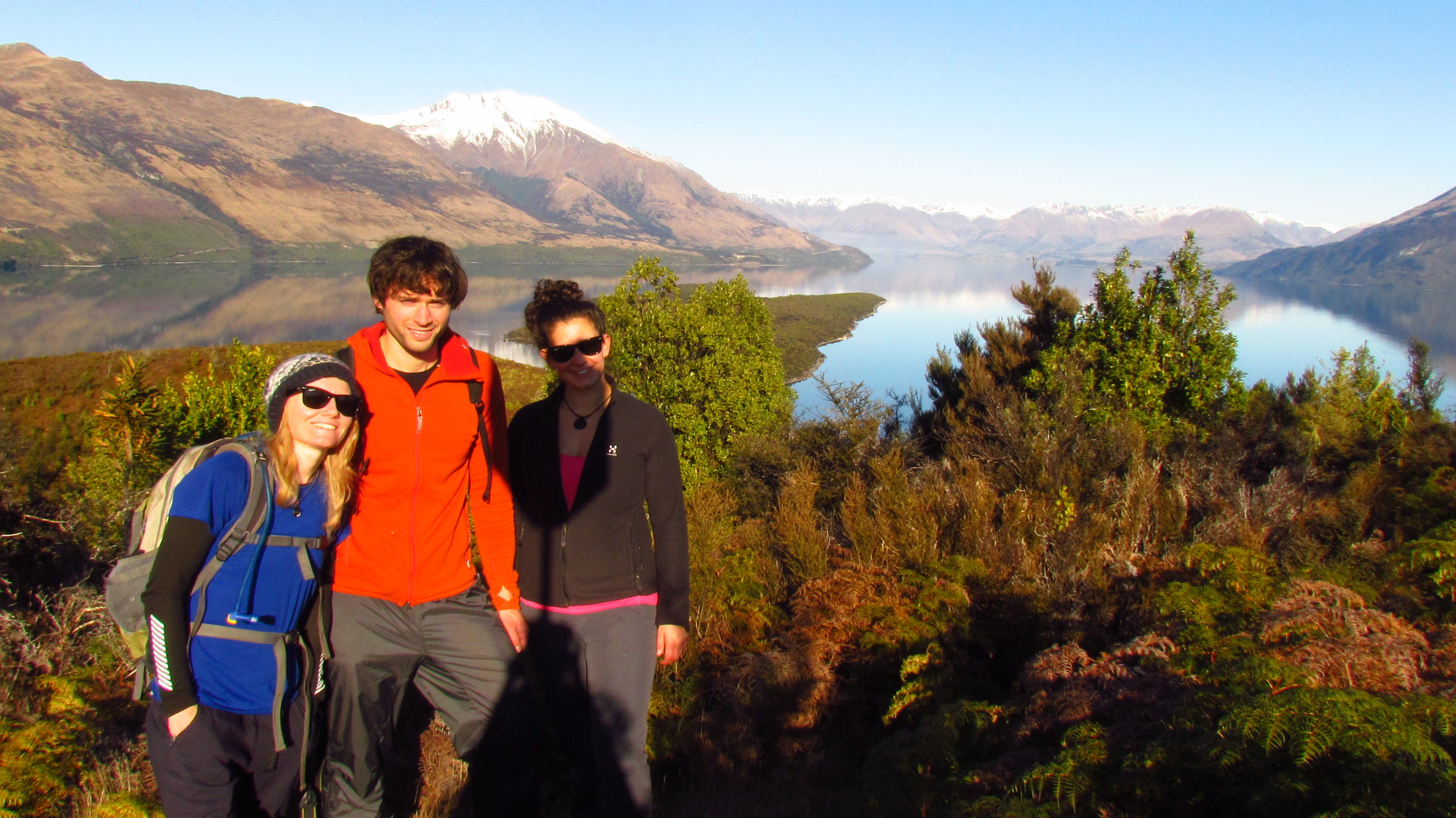
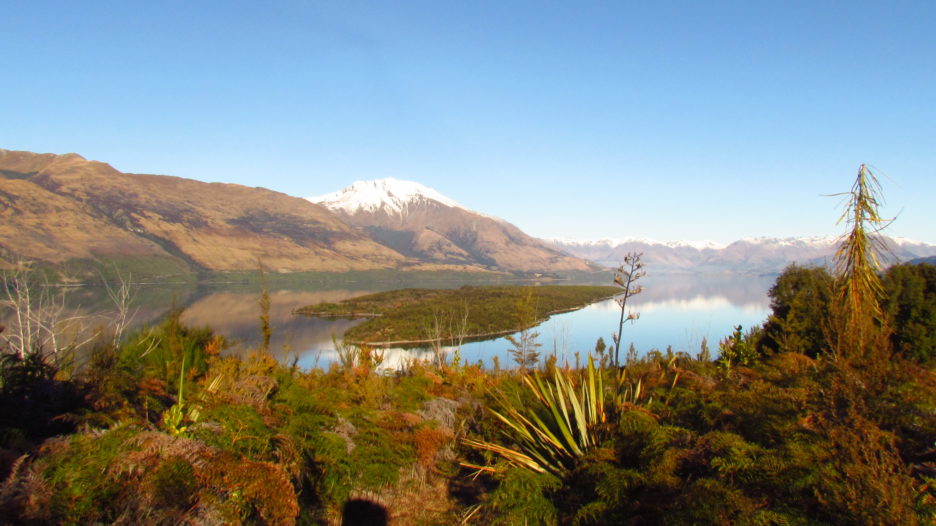
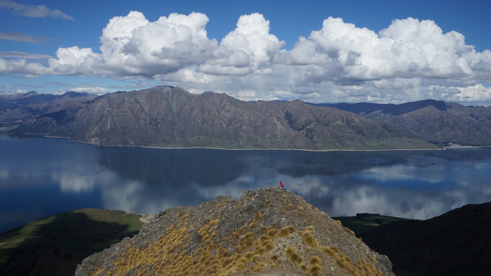
1. Isthmus Peak (Wanaka)             

Best For: Lake Vistas and all-round awesomeness

When it comes to day hikes in and around the Wanaka area, everyone seems to be all about Roys Peak. But for us, the lesser known Isthmus Peak is where it’s at. The trail, which begins near the head of Lake Hawea, just a short drive from the township of Wanaka, offers expansive views across Lake Hawea, Lake Wanaka and the Southern Alps. That’s double the punch of Mountains and Lake Vistas. 

Incredibly, Isthamus Peak hasn’t hit the ‘backpacker’ radar yet in the same way that other peaks have- and that’s one of the things that we love so much about this trail.
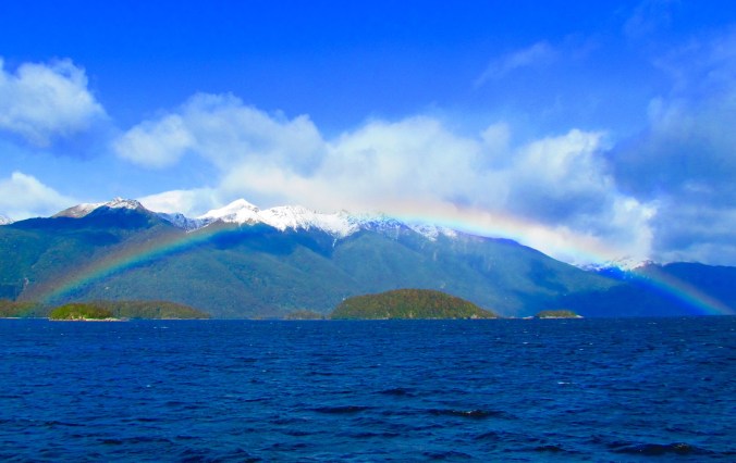
Lake Hawea

Lake Wanaka


2. Ben Lomond Track (Queenstown)                  

Best For: An Ariel view of the Adventure Capital

Looming above the metropolis of Queenstown is Ben Lomond. A lofty peak with a well maintained and marked trail which offers a unique view of the adventure capital of the world. The trail begins with a steep uphill grunt through sweet smelling Pine forrest, before it opens out and continues to ascend through alpine tussuck and shrubs, to Ben Lomond Saddle at 1326 meters. The Saddle is a great vantage point of the sourrounding valleys, peaks and lakes. But for really spectacular panoramic views that will leave you lost for words, continue up a rough, steep and slightly more exposed trail to the mountain summit at 1748 meters. From here, your valiant uphill effort will be rewarded with some of the most stunning 360 degree scenery that any of New Zealand’s day walks have to offer. To the North,  vast valleys and canyons cut through the landscape. To the South East is the infamous and striking, Remarkables Mountain Range. To the West the beautiful Moke Lake. And to the South across the vast blue waters of Lake Wakitupu, Walter and Cecil Peaks.It doesn’t get much better than this.  

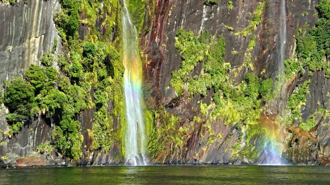
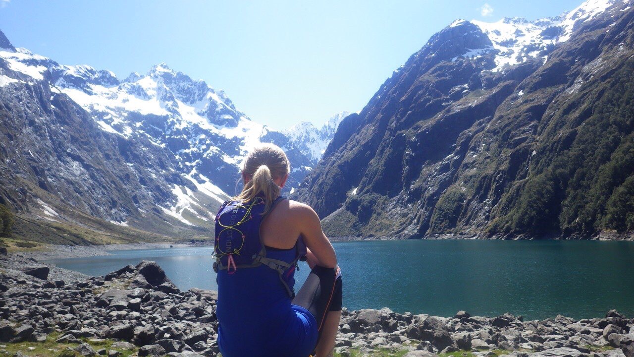
3. Gertrude Saddle (Fiordland)                         

Best For: Vast valleys and Sea to Summit views

Starting from an unnamed carpark on the eastern side of the Homer Tunnel is Gertrude Valley. This U shaped valley is an incredible example of Glacial carving and offers one of the most interesting and more challenging day walks in Fiordland National Park… if not the whole of the South Island.

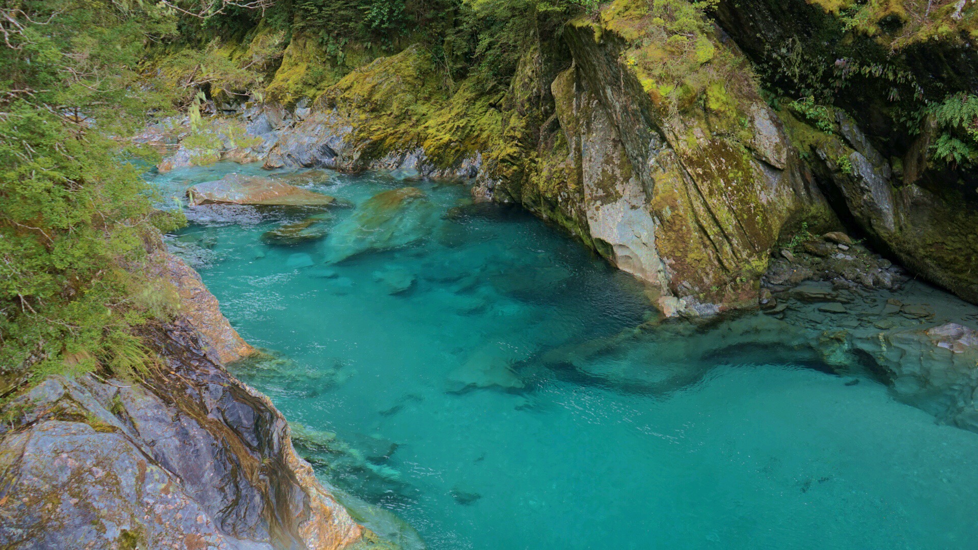
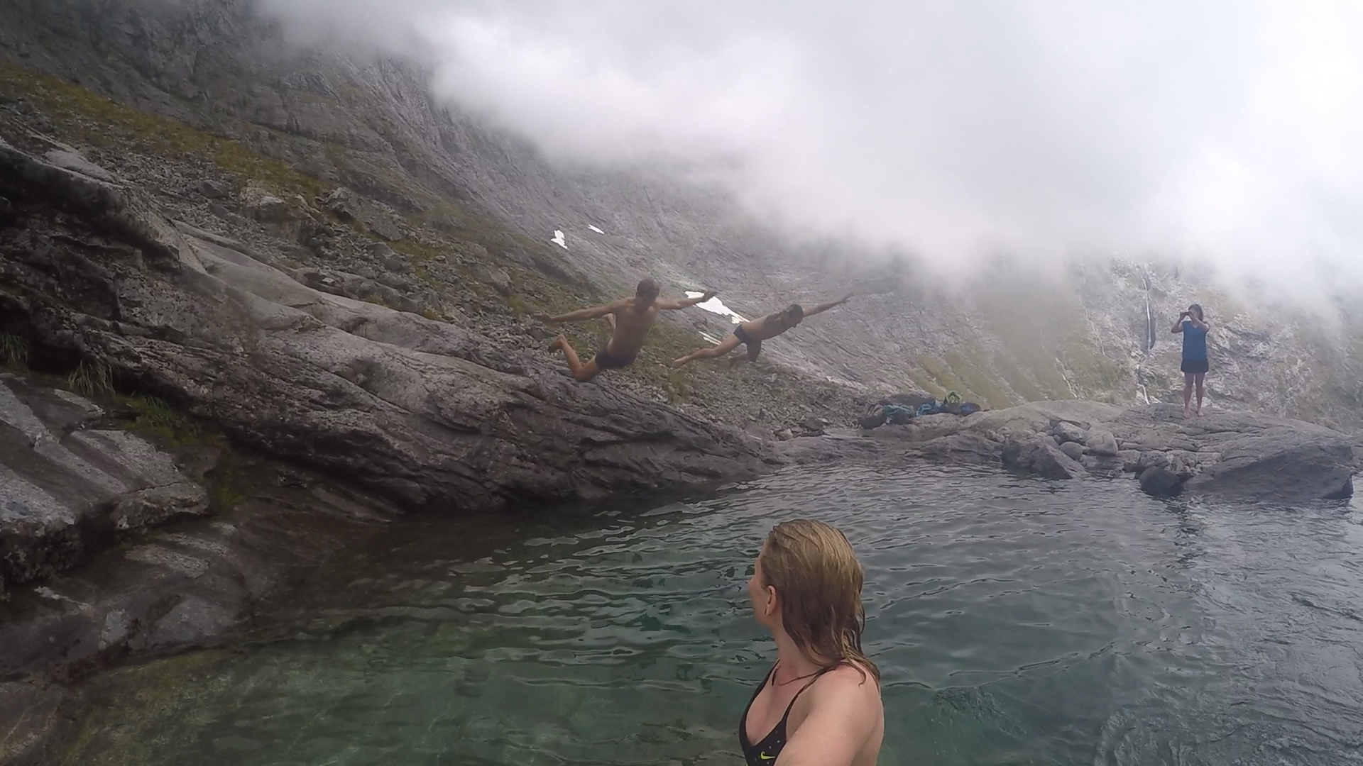
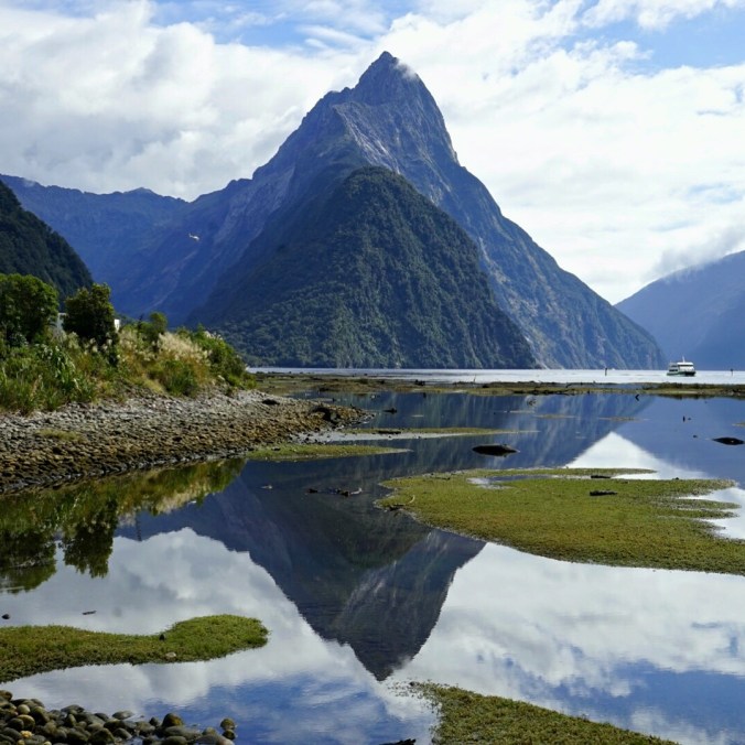
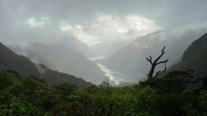
The trail to the valley head will take you across bolder strewn river beds, through a small section of native forest and across alpine meadows, before reaching the dramatic vertical walls at the head of the valley. Here, the marked trail abruptly ends and is replaced by a rough, unmarked trail dotted with cairns. Climbing steeply, the faint trail cuts up to the left of the valley, traversing gushing waterfalls, crystal clear rock pools and the dark waters of the aptly named ‘Black Lake’. As the terrain steepens to a near vertical scramble, a number of fixed metal ropes provide a welcomed relief for those with less of a head for heights and only add to the adventure of this trail. The Saddle itself affords views down a densely forested valley, all the way to magnificent Milford Sound and Tasman Sea. An epic view for those lucky enough to land a day in Fiordand which isn’t shrouded in low lying cloud! 


*Gertrude Saddle has challenging terrain and can become treacherous in bad weather conditions. It should only by attempted by those with suitable backcountry skills and experience. 

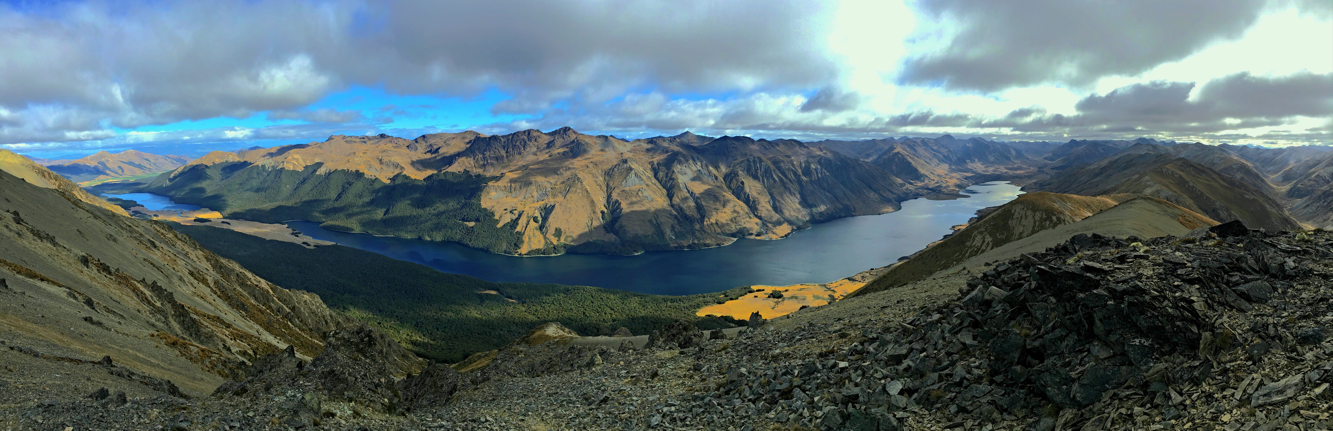
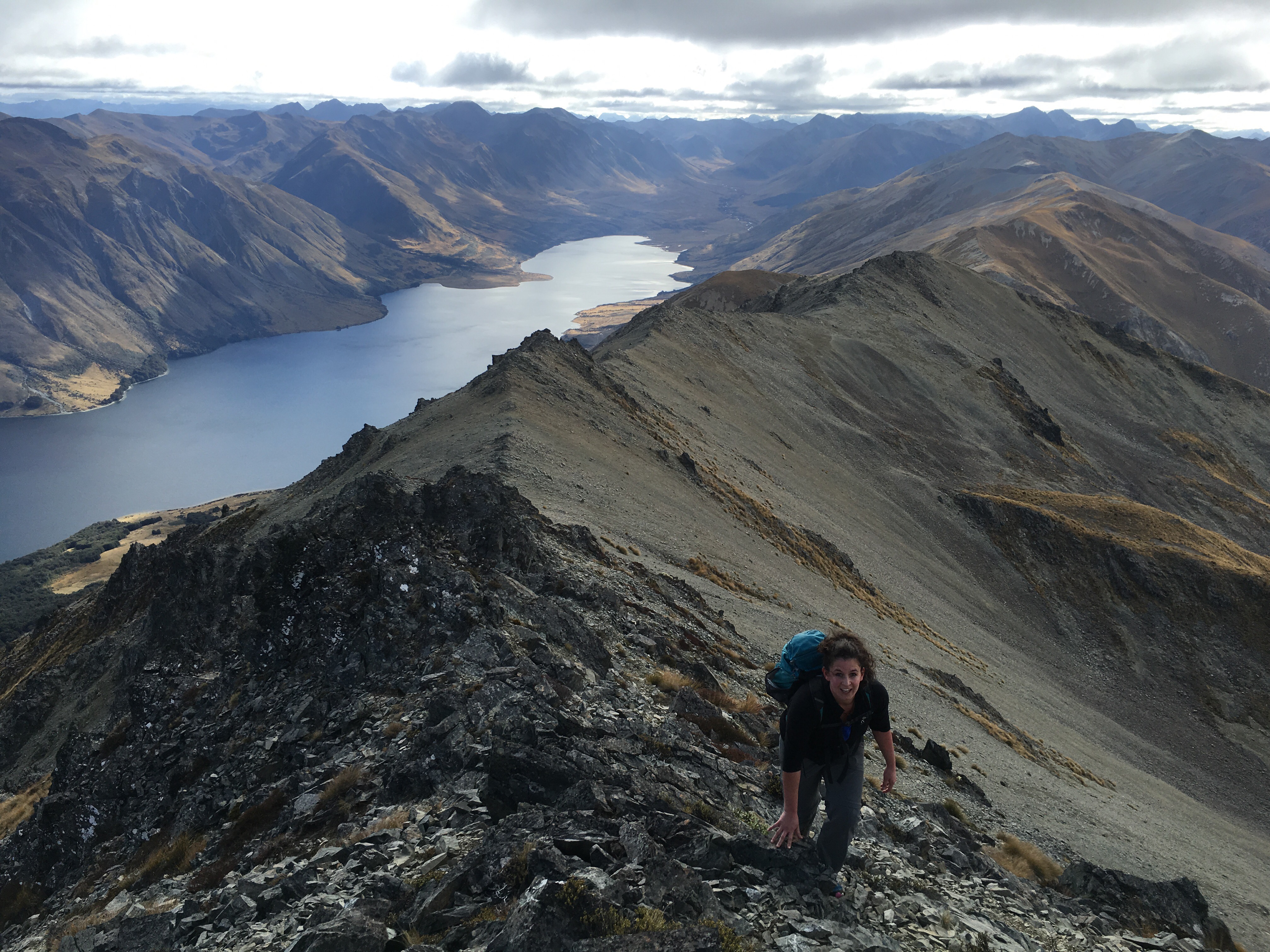
4. Mt Campbell (Mavora Lakes)              
Best For: Exposed ridge lines and escaping the crowds on off-trail adventures

If solitude and adventure is what you’re after, and you have the back country skills to match your enthusiasm, then Mt Campbell is a great option for an ‘off trail’ day walk. The summit, which sits at 1683 meters, provides spectacular views of the Livingstone Range and magical Mavora Lakes. In fact the landscape around Mavora is so strikingly beautiful that it was used as a number of filming locations for Peter Jackson’s Lord of the Rings series. 

Expect a challenge with this one. You’ll find yourself bushbashing through dense forrest, being sliced and shredded by vicious tussock grassland, and then precariously scrambling your way across narrow ridgelines. For me, this is what being in the Mountains is all about.


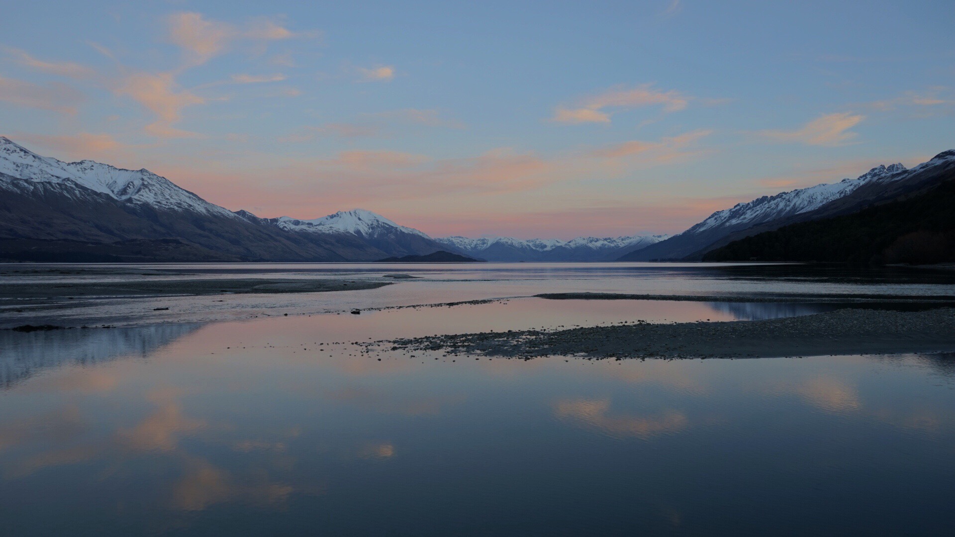
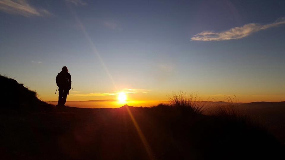
5. Roy’s Peak Track (Wanaka)              

Best For: Stunning Sunrise’s

If you’ve been around New Zealand for a while, then there’s a good chance that your Insta feed will have been clogged up with images of backpackers posing for selfies and jumping into the air starfish style on the popolur Roy’s Peak track. And its pretty easy to see why. The ridgeline that leads down from Roy’s peak to the vast waters of Lake Wanaka and its many picturesque islands, makes for an incredibly photogenic image that will keep you wanting to go back for more. 

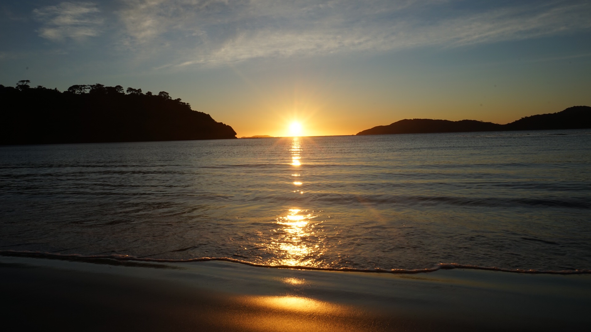
But for us, the down side to the beauty, relative ease and accessibility of this peak, is the big numbers of hikers it attracts. So to beat the crowds and enjoy the solitude that every mountain experience should entail, start your trek under the star  studded cloak of the nights sky to reach the ridgeline just before sunrise. Find a rock, park your ass, layer up and watch as the sky, peaks and lakes are touched by a kaleidoscope of colours as the fiery sun rises on the distant horizon. What a way to start a new day (and for me..my 30th Birthday!) Incredible. 


6. Mt John via Lakeshore (Tekapo)                        

Best For: Being awestruck by Azure waters

Mt John looks like more of a hill than a mountain and certainly would be classed as one in Hymalayan terms. But standing at just 1031 meters, this rounded peak offers a pleasant 3 hour circular walk, with vast views of the azure glacial waters of Lake Teapo, the hidden waters of Lake Alexandrina and the distant snow capped peaks of the Southern Alps. Perfect for a quick stretch of the legs before hitting the road.


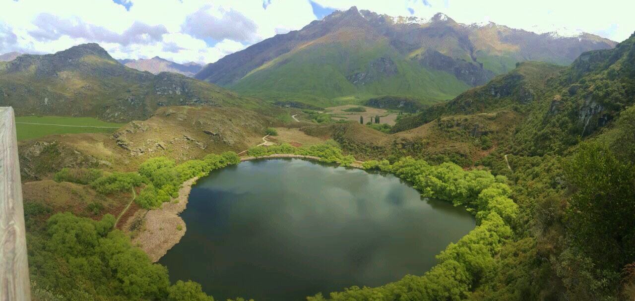
7. Rocky Mountain  (Wanaka)                      

Best For: Epic Views:Effort Ratio

Climbing this peak isn’t likely to leave the seasoned hiker with a feeling of accomplishment or even exertion. But for sheer epic views-to-effort ratio, for us, this trail wins hands down. 

Beginning from a car park on Aspiring Road just past Glhendu Bay (Wanaka), the trail passes Diamond Lake before gradually climbing to the Summit which boasts beautiful views down to Roys Peninsula and an entirely different perspective of the stunning Lake Wanaka. Normally I’m all about the circular walks, but if you want to get the best views this trail has to offer, plus a little exposure, we recommend taking the East Track on both legs of the journey for this one. Enjoy. 

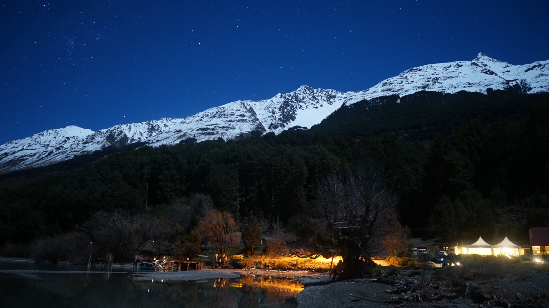
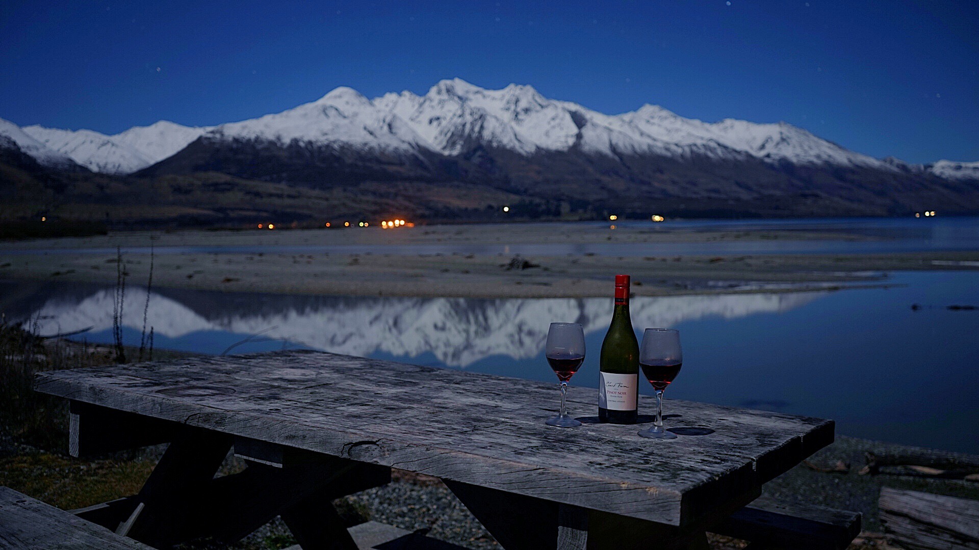
8. Mt. Alfred (Glenorchy)                          

Best For: Gazing out over graded rivers

At the northern end of lake Wakitupu, between two vast valleys stands a lone mountain- Mount Alfred. Offering incredible views across two graded rivers (Rees & Dart) and grandure of Aspiring National Park and the majestic Mt. Earnslaw, this took place as one of our firm favourites. Unfortunatley, access beyong the bushline to the ridge and sumit has been restricted recently, but we just couldnt exclude this one from our list! 


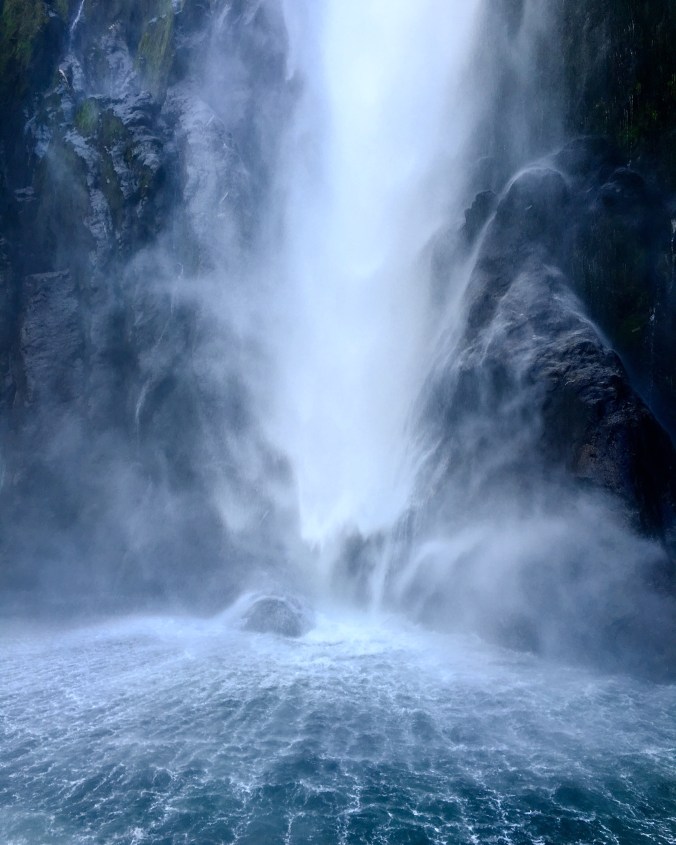
9. Lake Marian (Lower Hollyford, near Milford)                 

Best for: Hanging Valleys and Majestic Lakes

This track begins with a gentle ten minute stroll along a boardwalk next to the gushing white waters of Marian Falls. The track then becomes gradually harder and evolves into more of a rough trail with some small sections of easy scrambling- making for a more interesting ascent than your typical DOC trail. After a 1.5 – 2 hours push, you’ll find yourself at the foot of the captivating Lake Marian- an Alpine lake sat in a hanging valley, sourrounded by the Darran mountains- a spot that suprisingly often you can have all to yourselves. 


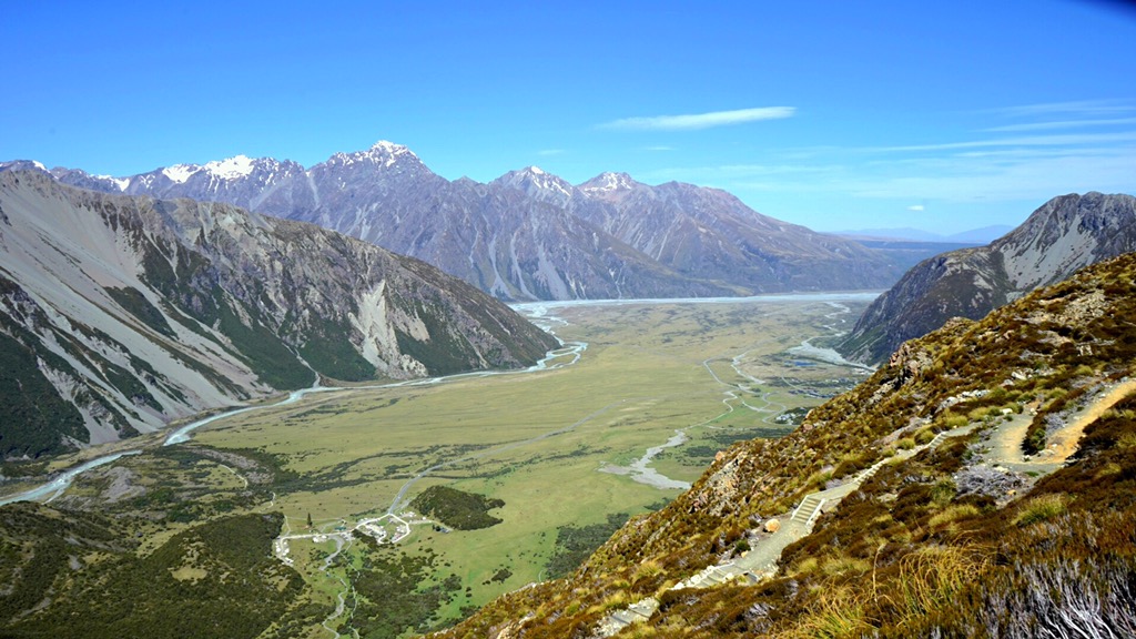
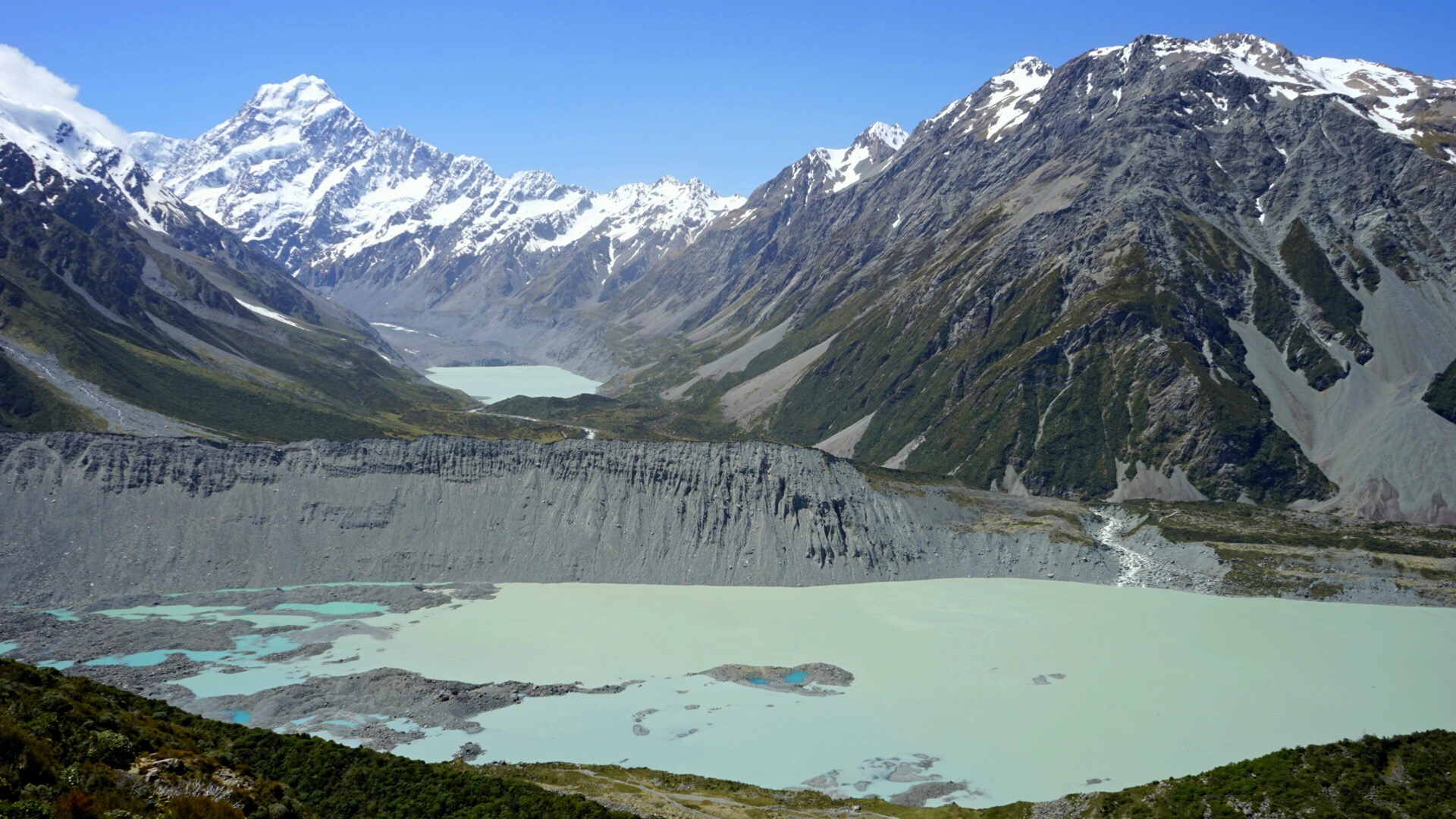
10. Sealy Tarns Track (Aoraki/ Mount Cook NP)                

Best For: Grand Peaks, ice bergs and sprawling glaciers

Home to sprawling glaciers, permanent snow fields and 23 peaks over 3000 meteres, you might think that Mount Cook National Park would be off limits to all but the most accomplished of mountaineers. But luckily, the creation of a number of trails in and around the Tasman and Hooker Valleys offer mere mortals, like me, a glimpse into a majestic and otherwise inhospitable landscape that is Aoraki. After much deliberation, we’ve decided that our favourite of all the trails, is the Sealy Tarns track. A 1-2.5 hour vertical slog up a never ending stream of steep steps will see you at a picturesque Tarn, overlooking arguabley some of the most stunning Mountain Scenary New Zealand has to offer. Continuing onwards and upwards for another 1-2 hours, you’ll reach the perfectly located Mueller Hut- a great option if your looking for an epic overnight Alpine experience. 

DON’T BE THAT GUY

As most people know, mountains may look beautiful but they can also be the most hostile of environments. Mountain weather can be changeable and when the those skies change for the worst, well trodden and popular trails have presented difficulty for even the most accomplished of hikers. During my time in New Zealand we’ve heard of too many cases of trampers winding up in life threatening  situations or unfortunatly loosing their lives to the Mountains.  
So Before setting out on any of the trails mentioned above, be sure to check that YOUR SKILLS and FITNESS meet the demands of the walk. ALWAYS pack accordingly. ALWAYS check the weather is suitable for the adventure. ALWAYS register your intentions with someone; and ALWAYS check the trail conditons. Many of the trails mentioned above are littered with avalanche pathways in Winter and Spring time and their terrain can become tretcherous, making them unsuitable for all but the most experienced of Mountaineers. Don’t be that guy. A cool ass photo simply isn’t worth your life. 

Oh and remember… “Take only photos, leave only footprints“. New Zealand landscapes are incerdible. Lets keep it that way! 🙂 

 Cool off this Summer in 5 of the TOP water holes NZ’s South Island has to offer

Jumping into icey cold water on a blistering hot sunny day is one of the simple joys in life. But combine this with stunning alpine scenery and pristine fresh water, and you’ve got yourself a swimming experience that you’ll never forget! So with summer fast approaching and temperatures beginning to rise, we’ve put together a list (in no particular order) of our favourite spots to cool off while backpacking New Zealands South Island.

1. Blue Pools (Haast)


There’s few places in the world that look truly inviting even on a rainy day- but Blue Pools is defiantly one of them! Just a short walk from State Highway 6 roadside, are a series of pristine pools carved out by millions of years of erosion. Acting almost like a basin, these pools catch azure blue glacial fed waters which are so clear that you’d swear there must be a giant sized Brita filter in there somewhere. Absolute Perfection.

2. Glendhu Bay (Wanaka)


Don’t fancy hiking for hours just to take a dip? Then check out Glendhu Bay. This picturesque bay is accessible straight from the roadside meaning you can park up, set up the deck chairs, get ou the barby and cool yourself off in Lake Wanaka’s crystal clear waters between baking yourself in the Summer sun. This water will chill you to the bones, so have your towel basking in the sun ready to warm you right up again. Happy Days!

No car? No worries! A walking/ cycling trail skirts the lake’s edge and starts at Roys Bay in the centre of Wanaka. This well paved, fairly undulating track allows you to take in iconic scenery, including the infamous “Wanaka Tree”. At Waterfall creek, continue along the track until you reach Glendhu Bay, enjoying secluded pebbled beaches and the majestic beauty of Mt Aspiring along the way.

3. Moke Lake (Queenstown)


Just 12kms outside of Queenstown, along an unsealed road lies the little hidden gem that is Moke Lake. This simple but beautiful DOC campsite is the perfect spot for a days picnic and a dip into refreshing waters. If you’re the camping type, this site will suit you perfectly. Pitch your tent on the waters edge, marvel at a starry night sky free from light pollution, and enjoy a morning bath that’s sure to wake you up and get you ready for an action-filled day in New Zealand’s Adventure Capital. During summer months, this campsite will set you back just $13 per person per night, and is only accessible by 4 wheel drive during winter/ spring months.

4. Innanomate pools, Gertrude Valley (Fiordland)


What better way to end one of New Zealand’s best day walks than by immersing yourself in one of the innanomate pools flowing down from Black Lake high above the Gertrude Valler floor. Even when shrouded in low lying cloud, the dramatic atmosphere created by the U shaped soaring granite walls and vast valley flats will leave you itching to jump in! Just remember you still have a long walk out from Gertrude Saddle and these waters are as cold as ice- so be prepared with a trek towel and warm dry clothes!! No one wants to ruin their jollys with a case of hypothermia!

5.  Lake Marian (Fiordland)


Lake Marian is an alpine lake that sits in a hanging valley, surrounded by snow capped mountains and is fed by glacial waters. Doesn’t sound like it could get much better does it? Well it can. You see, what makes this place even more spectacular is that it seems to be off the radar of most tourists and backpackers making their pilgrimage to Milford Sound… meaning that you pretty much have the whole place to yourself! Even the sandflies don’t seem to have heard much about this place! Definitely the perfect spot for a bit of skinny dipping me thinks 😉

A backpacker’s guide to crossing ‘An Encounter with a Kiwi’ off that ever growing bucket list

New Zealand is known as the land of the Kiwi’s. There’s the green or golden fruity kind. The gumboot wearing, pie eating human kind. And then of course there’s every New Zealanders favourite- the long beaked, feathery flightless kind- The elusive Kiwi Bird.

But despite being New Zealand’s National Icon, this Kiwi in particular proves a little more difficult to stumble across than your average tatty old pigeon down your local high street. So difficult in fact, that our quest to spot a Kiwi saw us travel to two different islands; trek over 40kms; scour tracks by day and deserted forests and backcountry lanes by night (sorry mum); sleep in rat infested camps; be devoured by swarms of blood hungry sand-flies; and even get chased off trail and into the thick bush by a ferocious sea-lion ready to rip us limb from limb. And was the pain, sleep deprivation, and blood loss all worth it you ask? Well for five minutes of solitude with a Kiwi in the wild, it most definitely was!


So if like us, you’re a nature whore, who’s trip to NZ just wouldn’t be the same without setting your beady little eyes on one of these big booty’d birds foraging in its natural fern filled habitat, check out these tips for spotting a Kiwi out in the wild without the expense and crowds of an organised tour.

Where to begin

Some wise guy once said it’s all about ‘location, location, location’ and when it comes to finding the Kiwi Bird it most definitely is (unless you have the luck of a Leprechaun that is!). Now endangered, these little balls of wonder can only be found in just a few remote, heavily forested locations around New Zealand. And not only are they rare and difficult to find, but they are also nocturnal, presenting another issue for the diurnal human who enjoys that beautiful thing called sleep! But strangely enough, there just so happens to be one anomaly amongst the Kiwi family and that is the Rakiura Tokoeka (Southern Brown) Kiwi bird. Unlike its other Kiwi relatives, this particular species of Kiwi bird is known to disregard natural Kiwi behaviour and dabble in foraging during the day (perhaps one of the reasons these little guys are becoming extinct!!). These day dwellers can be found on the shores of Rakiura (or Stewart Island, as it is more commonly known). And that’s exactly where our trail lead us.


To make the 30km journey across the Foveaux Strait, you can catch a catamaran with Real Journeys, who operates a daily Ferry Service service between Bluff, a costal seaside town famed for its Oysters, and picturesque Oban, the only town on the whole island of Rakiura. Prices very month to month and peak during the main summer/ tourist season. Tickets in November will set you back $75 each way, but buying a return ticket will save you some much needed dolla. Luckily ,if you need to shift your return journey back to give you more time to find that Kiwi Bird, Real Journeys operate a 24 hr cancellation/ modification policy giving you a little more flexibility with your trip!

 Stewart Island’s Kiwi Hot Spots:

  • Tracks and Trails

Steward Island’s 1746 km² of pristine wilderness is dissected by a number of remote, long distance tracks and trails that are prime Kiwi territory, but unless you have a lot of time and are willing to wade through chest high mud, you may want to give these trails a miss!

The most accessible of all of the trails on Stewart Island is the Rakiura Track– a 32km well maintained loop track and one of New Zealand’s ‘Great Walks’, which can be walked directly from Oban itself. On arrival, we were tipped off by a local DOC ranger that Kiwi birds are often spotted hanging around Port William Camp Site at dawn and dusk and also along the inland section of forest between Port William and North Arm hut during the day. As we were short on time, we opted to do the most picturesque section of the walk and camp overnight for optimal Kiwi viewing. Unfortunately, we lucked out on the Kiwi front this time, but I couldn’t recommend this 26km return adventure enough! This section of the trail is the most undulating section, beautifully scenic and if you don’t mind your pitch being overrun by rats and sand-flies, Port William is the perfect spot to end a days tramping, to watch the sun rise, and if you’re lucky enough, even catch the aurora on a super clear night.


  • Oban Township


 Notorious for being shy and reclusive, a township would be the last place you’d expect to find a Kiwi, right? Well apparently, you’d be wrong to think that! Once again we lucked out in our search for the Kiwi Bird in Oban’s coastal town, but if you read any hostel’s ‘Kiwi Sightings’ log book, you’ll find report after report of backpackers and tourists bumping into Kiwi’s in and around town as the sun begins to fade. Here’s a list of the current ‘hot spots’:

  • Traill Park- Take the short ‘Fuchsia Walk’ from Dundee street to ‘Traill Park’. This ruby pitch is boarded by dense forest and apparently Kiwi’s can be seen scurrying around the pitch after dark.
  • Raroa Walk- From the far end of the Rugby pitch on ‘Traill Park’, take the ‘Raroa’ trail through a section of forest rich in Bird Life. Lots of people have claimed sightings right along this trail that will lead you to the beautiful Golden Bay.

  • Loop the ‘Back Road’- This is only one I’d recommend as a last resort and if you have nerves of steel. Stewart Island feels like one of the safest places on earth and probably is, but regardless of that, there’s something ridiculously creepy about roaming deserted back country lanes for an hour and a half in the middle of the night. Every rustling bush and eerie screech will have you thinking you’re walking straight into the set of a horror film when your path is lit only by the beam of your torch. But according to a local fisherman we hitched with from Horseshoe bay to Halfmoon bay, making a loop of the back end of town in the early hours of the morning will lead you straight to a local Kiwi hangout. The junction where ‘Back Road’ meets ‘Hicks Road’, and the bridges over ‘Mill Creek’ are apparently particular hot spots! Route: Main Road; Back Road; Hicks Road; Horseshoe Bay Road; back to Main Road.


Ulva Island

 Despite doing lots of reading on Kiwi birds and the best places to find them, Ulva Island never hit our radar until the day before we were due to leave Stewart Island. But thankfully it did! This small predator- free, road- free, and virtually inhabitant- free island has become a sanctuary for rare and native birds such as the Kiwi, Saddleback, Yellowhead and Kaka parrot, and will leave you feeling like you’ve been transported back to Jurassic times when animals ruled the world.


Within 3 hours of being on the island, 3 out of the 4 couples we shared a boat with, left having had the Kiwi encounter they had hoped for…including us! And what a memorable encounter it was! With just 30 minutes to go before we departed the island, it looked like we’d be leaving NZ without even a glimpse of a Kiwi, when we were suddenly stopped in our tracks by a sea of parting ferns. Then to our absolute astonishment, in the board light of day, out pops a long protruding beak followed by a tiny head and a massive ball of a body! A kiwi bird at last! Scared that we would frighten her off, we froze to the spot and watched on as she thoughtfully strutted between us both and even got close enough to sniff Danielle’s brightly coloured shoes! Another epic and unforgettable fairy-tale moment in our travels around the world.


So before going trekking through forests with heavily laden bags; and wandering the back streets in the dead of night, fork out $20 for a return ticket to Ulva Island with Ulva Island Ferry , and even if you don’t spot a Kiwi, you really won’t regret visiting this beautiful place!

To give yourself the best chance of spotting the Kiwi and truly experience all of the flora and fauna that Ulva island has to offer, we’d defiantly recommend a full day trip. Take a picnic, relax and enjoy. And remember, leave only foot prints and take only memories. This is an amazing sanctuary- lets keep it that way.

The ferry departs Golden Bay Wharf (Stewart Island) prompt at 9am; 12pm; and 4pm* and returns from Post Office Wharf (Ulva Island) at 12pm; 4pm and 6pm* Monday-Saturday. No ferry service currently operate on a Sunday and take CASH ONLY payments. (*Summertime)


Top tip: Move slowly along the trail. Listen for rustles and be patient! Stand still for a little while and let the birds come to you. Once you see them fluttering around, kick up a bit of mulch and you’ll soon have Robins eating at your feet.


Stewart Island Top Tips

When to visit: Spring is one of the best times to visit the island. Bird watching is best at this time particularly for spotting chicks. There’s still a chance of an Aurora; crowds are fewer so accommodation and dining out is easier to wing; plus the weather is a little warmer than the cold winter months.

Where to stay: We can’t recommend Stewart Island Backpackers enough! This place has tent sites, dorm beds and private rooms; clean and ample hostel facilities and the staff are super friendly and helpful. They operate a cash back service meaning you can avoid nasty ATM fees and they are flexible with checking out time for tent pitches, meaning you can take your time and even leave your gear behind while you explore the island a little more.

Where to eat: There’s not too much in the way of food on the island. There is however a small Four Square Supermarket for all your basics. Expect to pay a little more than your average shop over here! There are also a couple of café’s; a Fish & Chip shop; and a pub called South Sea Hotel – We’d highly recommend the Fish and Chips here. The cod tasted as though it had jumped straight out of the sea and the batter and chips were to die for!

Banks: There are no banks on the island and only 2 ATM’s which you have to pay a fee to use- so stock up on any cash you might need before making the journey across the Foveaux strait!

Queenstowns Hidden Gem

Just visible from the pebbled shores of Kinloch, at the northern end of Lake Wakitupu, lies a cluster of small islands. The oddly named Pig and Pigeon Islands are lost amongst the vast volume of  water that makes up New Zealands longest lake, but these specs in an obis of blue comprise of more than 170 hectres of mostly untamed land.


Cut off from predators, the Islands have grown into a natural haven showcaseing some of New Zealand’s unique native flora and fauna. And thanks to New Zealand Department of Conservation, rough trails have been formed allowing the opportunity to explore all that the islands have to offer without being ripped to shreads during the dreaded backcountry pasttime of bush bashing.

But despite its beauty and tranquillity, it is a place rarely visited by tourists. And the reason? Well, although these islands lie just a stones throw from the tourist metropolis of Queenstown and run alongside one of New Zealand’s most scenic drives- ‘The Glenorchy road to Paradise’ – these lumps of land protruding from the waters of Lake Wakitupu are only accessible by boat. And with no companies operating commercial trips June through to september,  Wakitipus little known Gem, is inaccessible to all but the most inquisitive and determined of travellers during the winter months… Which to us made it all the more appealing.

And so a plan was hatched. We would arrange a day off from wwoofing at the picturesque Kinloch Lodge; get our hands on some Kayaks; paddle an unknown distance across open water; hit the shores of Pigeon Island; make a quick recky of the island; and head back home just in time for some delicious Kinloch Kai.

Unfortunately, in our eagerness for adventure, what we hadn’t accounted for was the southerly that was due to sweep in and smash Otago and Southland. Awakening the next morning we were greeted to a full blown storm which had transferred a usually picturesque lake into what resembled a ferocious sea.

Foolishly determined, Chris and I geared up and headed out to the boat shed at dawn as planned, Danielle reluctantly in tow. Stood in the lashing rain with a backdrop of rolling waves, Chris and I began our attempts to convince Danielle (and ourselves) that no, maybe the conditions weren’t exactly ‘perfect’. Maybe the water was a ‘little’ more choppy than we had hoped for.. and the winds a ‘little’ higher than what might be desirable for a 4 -5 hour deep water crossing… but it was “still totally do-able”. Un-phased by our wilful attempts to convince her otherwise, Danielle (who’d spent the best part of ten years of her life lifeguarding pools) took one look at the lake and then at us as and with a face of disbelief, turned around and quick marched back to Kinloch, point blank refusing to go anywhere near the water “on a day like today”. A decision which, as much as I hate to admit it…probably saved our lives.

Defeated by our commitment to make the crossing as a trio,  Chris and I sluggishly followed Danielle back to the lodge where we took our usual spaces next to the roaring log fire. The rest of the day was spent staring longingly out of the steamy windows at the onslaught of rain which had washed away our plans of adventure.

High winds and heavy rain raged on through the day and into the night and our chances of pushing on with our little escapade the following day seemed to be slipping further and further away. But with a new dawn came a new day… and what a day it was!! Brilliant blue skies. Not a cloud in sight. And not a hint of wind. It was on.

Psyched, we grabbed our gear (which for Danielle, included her beloved mini hot water bottle) and raced to the boat shed. In super quick time we dragged out the kayaks, suited up and pushed off from the graveled shoreline.

Mindful of the of Jet boats which usually tear into the bay from the graded shallows of the Dart River, our early morning journey across into the centre of Lake Wakitupu was a blissfully cautious one. It would take just two and a half hours for us to make the crossing and hit land, but it turns out that when you continuously use the body’s smallest muscle group to propel you through water for 150 minutes, kayaking can turn into a pretty painful affair! Luckily the serenity and awe- inspiring beauty of our sourroundings offered momentary distractions from the agony of lactic acid swimming around our shoulders.

IMGP9155

IMGP9166_edited

IMGP9179

IMG_9183

After dragging our Kayaks ashore, we took advantage of a quick refuelling opportunity accompanied by a couple of inquizative Weka’s, before setting off through thick bush in search of a trail. Without much effort at all, we stumbled across a well-trodden but a little over grown trail which took us around the circumstance of the island and up to its summit in little over two and a half hours.

The island itself was alive with the sound of song birds and from the highest point, offered stunning 360 degree views of the valleys and mountain ranges surrounding New Zealand’s longest lake. But the sweetest thing of all was that we seemed to be the only ones there to enjoy it. An island all to ourselves.

IMG_9179


IMG_9205


IMG_9221

IMG_9269

IMG_9296

But for Chris who was struggling with a knee injury and Danielle who was having to face her irrational fear of trees and (I quote) “green nature”, the end of the trek couldn’t have come any sooner!

IMG_9308

IMG_9260

Back in our Kayaks there seemed to be an unspoken determination in the air. Eager to avoid the plummeting temperatures of the winter nights and the ever changing conditions of an unpredictable lake, we paddled hard, racing the sun as it began to sink behind the white washed peaks of the Humboldt range.

But it wasn’t long before my sense of urgency was lost in the picture perfect scene before me. Resting my paddle across my soggy legs, my kayak eventually slowed to a stop. Sat completely alone, I watched as the peaks around me turned from a glistening white to a fiery alpine orange. Their reflections cast like a mirror image across the eerily still waters of the lake. It was one of those rare moments in life that makes you take a deep breath and realise how incredible the world really can be.

IMG_9313


As the day faded away into darkness we arrived back into Kinloch’s harbour. The lodges twinkiling lights and billowing chimney couldn’t have been a more welcomed sight on what was now an icy cold winters night. Slowly clambering from the kayaks, our hands frozen to the touch and our bodies shaking from the inside out, we briefly celebrated our sub 2 hour return paddle victory, before racing inside in search of a burning fire and that much needed Kai.

Another epic day in New Zealand.

*If your thinking of creating your own Wakitupu adventure, stay at the beautiful Kinloch Lodge and YHA. Make use of their Bike and Kayak hire and spend your evening enjoying the food available in their delicious restaurant before relaxing with a glass of your favourite red in the hot tub under a starry sky. For guided tours on Wakatipu check out Kinloch Lodge or for a guided tour to Pigeon Island, we are informed a company called Rippled Earth operate commercial tours October through to May. 

http://www.kinlochlodge.co.nz

*Please note….This information is correct to our knowledge at the time of publication 🙂


 Milford or Doubtful Sound… Backpacking dilemmas in the land of the Long White Cloud

A trip to the popular Milford or Doubtful Sound usually ranks high on the bucket list of most backpackers travelling around the Land of the Long White Cloud. But with dozens of companies operating year round commercial cruises in two differing “Sounds”, it’s difficult to know which to visit, at what time of the year and how best to experience one of New Zealand’s most acclaimed natural attractions.

So, as we’ve somehow wound up having Fiordland National Park as our back garden, we’ve been lucky enough to try out most cruise and kayak trips available in this beautiful part of the world and decided to put together some tips to help you get the most out of your time here.

So, which Sound??

Two of the most common questions we’ve been asked since working in Te Anau have been: ‘What’s the difference between Milford and Doubtful Sound?’ and ‘ Which one is better?’

And the truth is… there’s no easy answer.

Labelled Sounds by early explorers, Milford and Doubtful are both in fact Fjords (or Fiords) and are just two out of a total of 14 fjords that indent the 215km of Fiordland World Heritage Coastline. Carved out by the crushing power of ancient glaciers, both offer scenes of undeniable beauty. Towering peaks soar vertically from the dark waters below. Thunderous waterfalls cascade over rocky outcrops. Forests of ferns and Beech trees cling precariously to sheer rock faces. And rarely seen sea life can be spotted taking haven from the turbulent Tasman sea.

image

So in terms of the perceived environment you will be immersing yourself in, there is little difference. The most noticeable differences between Milford and Doubtful Sound instead lie in their size, price tag and the feeling of wilderness and isolation that they project.

image

Milford Sound is arguably one of New Zealand’s biggest tourist destinations and it’s easy to see why. This narrow fjord will leave you feeling insignificant beneath its soaring summits and in awe of the majestic Mitre Peak.

image

And arguably as beautiful as Milford itself is the journey to get there. Milford can be reached via state Highway 94, just a 2 hour drive from Te Anau- making this easily the most accessible Fjord in Fiordland National Park. This historic road skirts Lake Te Anau, New Zealand’s 2nd largest lake, before following the Eglinton River through dramatic valley flats. From here the road winds and climbs to a staggering 945meters through the Darran Mountains before climaxing at the infamous Homer Tunnel. This feat of human engineering and ingenuity carves its way 1.2 km through a wall of otherwise impassable rock, opening up a hair raising decent into the beautiful Milford Sound.

image

Along the way you’ll pass pristine mirror lakes; raging waterfalls; glacial rivers; sublime mountain scenery; deep rock chasms and endless vantage points offering views of the surrounding forested valleys. If you’re a keen tramper, this road also gives you access to (in our opinion) some of the best short and multi day walks that the South Island has to offer!

image


Top Tip: Opt for an early morning cruise. Make ‘Mirror lake’ your only stop en-route to Milford and then after your cruise, spend the rest of your day exploring this beautiful road and all it has to offer on your way back to Te Anau. This itinerary does mean a fairly early start, but dragging yourself out of bed that little bit earlier will help you get the most out of your trip to Milford, and with generally lower winds and calmer weather patterns early morning, you’re more likely to get those picture perfect views.

image

Doubtful Sound is a fjord of epic proportions. Stretching its crooked arms outward from the dense forests of Fiordland to the turbulent waters of the Tasman Sea, Doubtful Sound is around three times the length and ten times the area of Milford Sound.

image

Cut off from public road access, the only way to reach the shores of Deep Cove and embark on a cruise or kayak adventure in Doubtful, is to first take a 60 minute boat ride across the beautiful Lake Manapouri before boarding a coach and travelling up and over Wilmot Pass. This mountain pass is notorious for the challenges mother nature can throw at it- but the long journey is well worth the time and effort.

image

Doubtful offers a remote wilderness experience a world away from the busy tourist terminals and endless passing of vessels on the water ways of Milford Sound. Jurassic in appearance and ambience, it truly is a slice of serenity in an otherwise busy world.

image

So with all of this in mind, which Sound should you choose? Well, if money is no object then an overnighter in Doubtful, along with a day trip in Milford and a scenic over-flight of the National Park will give you the ultimate Fiordland experience. But if, like most backpackers, you’re conscious of that ever dwindling bank balance, then your more than likely going to be investing your hard earned cash into just one of these trips.image Continue reading

A taste of S.E Asia

After leaving Nepal we would travel to three different countries and hop between six different islands on what turned out to be an epic and eventful Asian adventure.

Batu Caves, KL

Batu Caves, KL

An adventure which took us from the culinary delights of the multicultural Kuala Lumpur, overland on a 7 hour train journey to the bright lights of Asia’s little red dot, Singapore. A western metropolis sticky with humidity, where smokey temples rub shoulders with soaring sky scrapers.

Sunset behind the Petronas towers, KL

Sunset behind the Petronas towers, KL

Exploring the boutiques and eateries of Kampong Glam

Enjoying the 'Wonder Full' light and sound show at Marina Bay Sands

Enjoying the ‘Wonder Full’ light and sound show at Marina Bay Sands, Singapore

Singapore Skyline by Night

Singapore Skyline by Night

After a whirlwind 24 hours, we left Singapore’s western ways behind, bypassed Indonesia’s sprawling concrete capital Jakarta and headed directly to Yoyakarta, the heart and cultural soul of Java. Here bearing shawls, we hung with locals and explored Yoga’s many historic sights, before travelling overland on a testing journey of bemos; buses, and trains to the moonscape of Mt. Bromo.

Budda

Borobudur, Java

Prambanyan

Prambanan, Java

IMG_6708

Phototime with the locals, Kauman, Java

A journey in which we would loose our clothes to a laundrette fire; find ourselves walking through the centre of an Islamic Extremist Demonstration; being thrown out of a taxi in the middle of nowhere; trying to stop what appeared to be the abduction of a woman; dodging a torrent of aggressive touts; and avoiding being forced off a bus by scammers. To say that this was our most testing traveling experience yet would be an understatement. But the kindness of locals and travellers we met along the way made it  a more enjoyable one.

IMG_7343

Nothing like a stroll around the rim of an active volcano to start the day, Mt. Broom, Java

Sunrise over Mt Bromo

Sunrise over the billowing Mt Bromo

Nr. Mount Bromo

Exhausted and a little broken we arrived into Bali, where we would spend the next two weeks taking advantage of some much needed R&R. We sipped cocktails and partied with drag queens in Seminyak; chilled in hammocks with friends while living like beach bums on the paradise that is the Gili islands; and finally explored the less visited palm fringed beaches on the developing island of Lombok. It was the break we had needed.

Gili T

Gili T

Gili Meno IMG_7762

Gili Air

Gili Air

But with S.E Asia’s wet season looming, there was no time to hang around. Keen to avoid yet another natural disaster, we decided to score our selves a couple Working Holiday visas and put our Asian adventure on hold for drier times. So in early  June, we swopped  the sweltering tropical heat of Indonesia for the sub zero temperatures of the picture perfect Land of the Long White Cloud- ANew Zealand.

And so began the next chapter.

Leaving Nepal: A sobering Journey

The 7.9 earthquake that struck Nepal on the 25th April brought our Himalayan adventure to an abrupt end. The idea of pushing ahead with our plans and trekking to EBC where so many had just lost their lives seemed like a tasteless option. Unable to offer the skills to help with the initial disaster relief effort, we were left wondering what to do for the best. But with constant tremors, predictions of earthquakes of a bigger magnitude, the threat of disease spreading and supplies running low, we reluctantly made the difficult decision to leave behind a crumbing Country which had captured our minds and stolen our hearts.

Abandoning the picturesque lakeside village of Pokhara, we set off on a four hour journey through winding lush green valleys to the devastation and chaos of Kathmandu. It was to be the most sobering journey of our lives.

Desperate locals taking to the roofs of buses to flee Kathmandu

Desperate locals taking to the roofs of buses to flee Kathmandu

Passing by villages that were now nothing more than a pile of rubble; houses which balanced preciously on their side like tumbling dominoes, and squadrons of soldiers bearing shovels, we realised how sheltered we had been in the largely unaffected area of Pokhara.

Nepali earthquake three

Nepali earthquake five Nepali earthquake one

Nepali earthquake four

Arriving safely at Kathmandu Airport we had a long wait amongst the hordes of fleeing tourists and Government Officials until our delayed flight would leave the ground. Sat on the floor, I thought over what I had just seen and our privileged decision to leave. I felt sick to the stomach. These beautiful people had lost everything. Their homes, their livelihoods, their loved ones. Everything! And we were deserting them in their hour of need to look after ourselves. I had never felt more selfish.

Later that evening, teary eyed and exhausted we flew out of Nepal just ten days after the biggest quake to hit the Himalayas in over 80 years.

And so began the next chapter of our travelling adventure.

The Annapurna Circuit: An Epic Himalayan Adventure

Throng La

Hailed as one of the most spectacular long distance walks in the world, The Annapurna circuit had a lot to live up to. But, our 130 odd mile horseshoe trek through Nepal’s central Himalaya region more than exceeded any of our expectations.

This popular trail may lack the lavish huts and sense of isolated wilderness offered by other treks around the world, it may not even have the best scenery; but what it does offer is the opportunity to explore an ever changing landscape, stand in the shadows of four of the world’s highest snow-capped peaks, and to experience the kindness and cultures of the communities who, despite adversity, inhabit these unforgiving lands.

The first 5 days of our 18 day journey from Besisahar to Nayapul were spent trekking towards the source of the mountain river Marshyangdi. We crossed wooden swing bridges which swayed precariously over the sapphire rapids below; walked beneath cascading waterfalls; meandered through rice paddies carved into the climbing countryside; scaled sweet smelling rhododendron forests; and were left astonished by the ingenuity of the farming villages we called home each night. And too be honest, it all felt a little too easy. It was nothing like the white washed Himalayas which I had seen on TV and the views although beautiful, could easily have been rivalled by some of our favourite spots in England’s Lake District.

Rice terraces IMG_4680IMG_4561IMG_4660

But on day six as we left the village of Chame at an altitude of 2630m and began to ascend further towards the climax of our journey, the infamous Thorong-la Pass, the terrain began to drastically change. Spindrift and threatening clouds now loomed above a skyline dominated by grey and white soaring walls of intimidating rock. Vultures circled overhead, preying on the frozen remains of Yaks which had been taken by the harsh alpine conditions. Boulders crashed and tumbled down the fell-side around us, whilst the thunderous noise of distant avalanches echoed in our ears. It was a stark contrast from the blue skies and lush green vegetation of the valleys and foot hills below. And with every step we took, we became all too aware of each shortening intake of breath in the thinning ar. It was as if the mountains had sent a glaring reminder of the hostile environment which we had chosen to explore, and of how dispensable and insignificant we are. We were at the full mercy of the greatest mountain range on the planet, and it had decided to send a blizzard our way.

VultureIMG_5215snowIMG_5194

Likened to that which killed over 40 trekkers in October 2014, the snow fall caused what seemed to be a panic amongst Sherpa’s in Menang village, with many groups, guides and porters abandoning their treks and heading downhill to the safety of the valleys below. But determined to make the pass, others like ourselves decided to wait out the storm in the sub- zero temperatures of the wafer-thin walled tea houses in hope of a break in the weather, and after just two days we were blessed with just that.

The track now covered in thick snow, compacted by an endless stream of trekkers had become treacherous under foot. For those struggling with altitude sickness like Danielle, each movement became a slow and painful slog to the fluttering prayer flags of Thorong- La Pass.

To avoid high winds and melting snow, the final ascent was made in the dead of the night. Guided by only the flickering light of our head torches, we pushed on uphill through a landscape now undistinguishable and eerily quiet.

IMGP4527 IMG_5249

But as dawn broke, the darkness faded to reveal a 360 degree view of soaring Himalayan peaks. Stood at 5416m on a blanket of glistening snow, we were rendered speechless. Nothing compared to the scale and beauty of this picture perfect scene. Not skydiving over Franz Josef glacier; not an aerial view of the Great Barrier Reef; not swimming with Whale Sharks. Nothing could ever compare to this. It was nature at it most beautiful and it was truly breath taking.

IMG_5334 Inhaler

hymalayas 2

The decent from Throng La was a long and arduous five hours of slipping and sliding down hill, but for us the adventure was far from over. Continuing on from Muktinath where the majority of trekkers end their Annapurna experience, the trail led us through Nepal’s arid semi desert land where we searched the river banks for ancient fossils; plentiful apple orchids where we feasted on pie; and sweat inducing sub-tropical rain forests where we heard the calls of the Cuckoo bird, before eventually leading us to our penultimate destination of Poon Hill.

 desert IMG_5660

Apple orchards fossils

Here, after a 4am climb, we stood sharing a cup of steaming hot lemon, ginger and Honey tea as we watched the rising sun’s rays one by one touch the snow-capped peaks of the entire Annapurna range, creating a fiery orange Alpine glow across the horizon.

A majestic ending to a perfect Himalayan adventure.

Poon Hill POON HILL 1 Fishtail

An earthquake in Nepal: A shaky start to our Backpacking Adventure

Kathmandu

Yesterday began just like any other day. Sat crossed legged on the straw floor of our bamboo garden hut, we chatted trivially over peanut butter and banana sandwiches about our plans for the day, before waking ourselves up in a spine chilling icy cold shower. It was the average morning of a budget conscious backpacker in Nepal.

Leaving Claire behind to relax in the guesthouse, Danielle and I headed into the main town under a threatening sky, to rummage through the delights of Pokhara’s colourful lakeside stalls.

Inside a dark and dusty shop, stacked high with yak furs and “cashmere” shawls, we stood bartering with a Nepalese man in broken English, a shopping ritual we have quickly become accustomed to. Suddenly the lights in the store flickered on and off, plunging us almost into darkness, before a stampede like rumbling echoed through the open door. Pushing past us mid-sentence without saying a word, the formerly sale-eager owner frantically ran from the shop leaving us and his livelihood behind.

At that moment the street outside burst into a chorus of screams and shrieks from people and animals alike. Locals and tourists ran in all directions eventually forming a sea of bodies down the centre of the road. For a second I stood confused and then as the ground began to tremor beneath my feet, it hit me, this was an earthquake. It was as if my mind had been kicked into survival mode, scanning for falling debris, ground cracks, electric wires, and injured people, I grabbed Danielle by the arm and dragged us into the chaos that now swept the previously relaxed streets of Pokhara. Diving between the masses, we quickly made our way into the crowds and tried to dodge the tangled streams of power lines which now swung wildly over our heads. Our hearts pounding in our chests, we stood huddled together helplessly watching as chaos unfolded around us. It was as if time had stopped. Windows rattled violently in their already crooked wooden frames. Buildings and concrete structures swayed and spewed out bricks onto bystanders below. The unsecured contents of bottle shops tumbled and smashed creating a river of red across the paved walk ways. And then the quake hit its climax. As if standing on the rolling waves of a stormy sea, we were thrown uncontrollably from side to side. The floor visibly shifting in either direction. Random travellers gripped onto us for safety, their faces white with fear.

After what felt like an eternity, the chilling shaking began to ease. Racing back along the main street towards our quaint little guest house where we had left Claire earlier that morning, we passed local men brought to their knees, crying, unable to breathe. Families flocked around women who had passed out, unable to cope with the terror. Groups of hysterical travellers gathered together looking around dazed and in shock. It was a scene I have watched ten times over from the safety of my home in England. But this time it felt real. We were actually amongst it.

Arriving at the guesthouse we were pleased to find Claire and the Nepalese family we are staying with unharmed by the morning’s events. Cut off from TVs; internet and the English language, we sat on a derelict field through the aftershocks with fellow travellers, excitedly sharing stories, completely unaware of the scale of devastation and loss of life that had occurred around us.

Soon after the ground settled, we headed to a Thrakali kitchen in search of Dal Bhat and watched locals glued to hand held radios, but unable to understand the content or ask questions, it was from a local shop keeper that we learnt the true devastation of the quake.

A stomach turning realisation swept over us. This wasn’t a cool or fun experience anymore. This was a serious disaster. People had lost their lives. And we were truly lucky to still be here.

Hours passed before we were able to make contact with friends, family or the outside world. But eventually one by one as Wi-Fi connections were restored, the news began to filter in through the desperate calls and messages of loved ones. ‘7.9 on the Richter scale’. ‘The biggest quake the Himalayas have experience in over 80 years’. ‘Over 1000 dead, many of whom were tourists.’ ‘Avalanches and ice falls have flattened Everest Base camp’.

We were left in total shock. Guilty for feeling thankful that we were safe and well when so many others had lost their lives, and bemused by how a couple of seemingly unimportant, split-second decisions that we had made in the lead up to the quake had been the difference between me writing this blog today or being one of those unfortunate enough to be in the Everest region or Kathmandu at this horrific time.

It’s now just over 24 hours since the first earthquake hit Nepal and the death count continues to rise. We were awakened by a couple more quakes in the early hours followed by a series of tremors, in fact we’ve just had another fairly big one as I write this now. But other than reported road blocks and cut-off water supplies, Pokhara feels unharmed and relatively safe. So for the time being, despite wanting to help with the humanitarian aid in Kathmandu, this is where we will stay.

Our thoughts and prayers go out to all of those who have lost their lives or loved ones in this saddening disaster, to those selflessly risking their own lives to help others, and hoping for the safe return of all those who are lost xxx

Rome: A city frozen in time


Appian Way Italy’s capital, Rome, is a place where modern city life has blended effortlessly with ancient ruins to create an infusion rich in culture and atmosphere. It is a city where even the most devout atheists and unenthused historians would find it difficult not to be captivated by the historical legacies, artistic grandeur and human genius that Rome showcases around almost every corner.

Home to structural splendours such as the Colosseum, St. Peters Basilica, Trevi Fountain, The Roman Forum and the Panthéon, to name just a few, Rome is a traveller’s reverie.

But a trip to Rome is as much about indulging in fine wine, food and coffee on sunlit piazzas, as it is about immersing yourself in its remarkable past. After all, ‘When in Rome’…. It would be rude not to.

So how do you cram over two millennia of history, art and culture into just a 3 day city break? Well, luckily Rome offers a lot on a small scale, making exploration both easy and affordable; but with so much to see and do, it helps to go prepared with an itinerary to get the most out of your journey to the eternal city.So here’s a few ideas to get you on your way…

Rome Day One: There’s no better way to start a trip than with a showstopper, so todays all about the Roman Ruins. Now were not usually over keen on tourist hotspots, but standing within the arched walls of the grand Colosseum, the noise of excitable school groups and the constant flashing of cameras was quickly phased out, leaving just you. You, and the uproar of 80,000 barbarians, cheering and chanting, blood thirsty for the next pauper to be ripped limb from limb on centre stage. The practice of gladiator combats and killing for entertainment may be long gone in Rome, but the atmosphere generated by this impressive building, and the tales within, is still very much alive.

After circling the arena and taking in the ever changing perspectives that each level offers, take the short walk across to The Roman Forum and Palatine Hill, which are equally as fascinating in their own rights. Together the three sites make for a fantastic day in Rome.

Spend the remainder of your day, moseying around the streets of Rome and climb Parco Gianicolense for sunset, before heading to Travestere, a district famous for its cheap, authentic food. If you’re a Pizza lover check out ‘Carlo Menta’ for excellent slices at dirt cheap prices.

Pent Day Two: Start today with a visit to Trevi Fountain and the Panthéon before taking a stroll above the river banks of the Tiber to Vatican City. If your feeling fit and have a head for heights (and small spaces), it’s well worth paying the €5 fee to scale the 551 steps to the top of St. Peters Dome.

Winding your way up the ever slanting and narrowing wooden staircase, you’ll pass through beautiful mosaic artworks and marvel at the scale and magnificence of the basilica before emerging outside for a 360 bird’s eye view of this beautiful city. Take the time to spot some of the great sights in the distance, as well as the gated, pristine Vatican City which lies below.  As you leave these spectacular views behind and begin to descend yet another spiral staircase, why not stop In the Nun-run Holy shop to send a postcard from the smallest state in the world.

The final corridors and stairwells of the dome lead you down into St. Peters Basilica itself, an artistic masterpiece which will leave you astonished.

IMG_3442_edited           IMG_3669

Take a long walk or catch the metro to spend the last hour of daylight at Pincio Hill (above Piazza del Popolo) watching the sunset over the city and St. Peters Basilica before making your way south through the park to emerge at the Spanish steps. Spend a while soaking up the atmosphere here before disappearing into the lights of the city in search of culinary delights.

St Pauls Catherdral


walking the appianway Day Three: After 2 long days of sightseeing your feet will be screaming out for a much needed rest today, and what better way to relax than cycling through lush green countryside and crumbling ruins on one of the Romans greatest engineering feats! The ancient Appian Way, or Appia Antica as its known locally, lies just outside the city walls and tracks over 350 miles from Rome to Brindisi in the heel of Italy. It’s well preserved giant cobbles offers travellers the opportunity to escape the crowds of the city and really get a sense of stepping back in time to an era untouched by modernity.  But beware if you stick to the road- you’re in for a bumpy ride!! For those who prefer to admire this piece of history from a more comfortable position, you can take advantage of dirt tracks which have been carved out for your convenience.riding appian way

Before peddling your way back in time, why not stop to explore a darker side to Rome and head deep underground into the network of caves, tunnels and tombs of the Christian Catacombs.  Note- If you’re not keen on confined spaces, the dark or the dead, a tour around this place probably isn’t for you!

After  you surface from below and have lost a couple of hours cruising on your bike, enjoy a late lunch in the garden oasis of the Appia Antica Caffe, before making your way back along the cobbles to catch the bus where todays adventure began at St. Sebastian Catacombs.


The logistics (Day 3): Take the metro to stop CIRCO MASSIOMO (near to the Colosseum). Cost approx. €1.50 each way from Termini. Walk outside the station to the bus stop on your left and take Bus 118 to Stop St. Sebastian. After visiting the Catacombs, take a pleasant 10/15 minute stroll along the cobbles to the Appia Antica Caffe where you can hire bikes for a good price. We paid € 9 each for 3 hours of rental. Bike hire is calculated per hour of rental and payment is made when you return you bikes to the café. One form of ID for one person in your group must be left with the café for the duration of your ride (http://www.appiaanticacaffe.it/new/index.php/en/bike-rental).

Take advantage of: Discounts: Under 25s can claim discount when purchasing the ticket which gets you into the Colosseum, Roman Forum and Palestine Hill. ID must be shown proving age.

Watch out for: Pickpockets. Like most tourist hotspots around the world, Rome has many pickpockets operating within the Metro system and on the streets, particularly around the major sights. Be vigilant with your belongings and don’t be distracted by decoys such as that cute puppy “all on its own”.

Remember to:

  • Check the opening days/ times of the attractions you are visiting (many shut on alternate days) and arrive early to avoid long queues.
  • Purchase bus tickets from Tobacco shops before boarding a bus and be sure to buy return tickets if you’re heading out to Appia Antica!!
  • Always carry a bottle of water with you. The Mediterranean heat and lots of walking can be a killer!

Our Hostel Pick: Freedom Traveller – A cheap and cheerful hostel well situated in the centre of Rome, close to Termini Station. If its luxury you’re after then this place isn’t for you, but if you’re looking for a friendly, sociable atmosphere close to all the Must-See’s then this hostel will be perfect for any budget-conscious traveller! Take advantage of the free nibbles and wine in the evening, and continental breakfast in the morning!

Our month to travel: March/ April. The weather was cool enough to comfortably enjoy roaming the streets and seeing the sights for hours on end; but warm enough to warrant a refreshing pit stop at one of Rome’s many Gelaterias. The evening is generally a lot cooler at this time of year so be sure to pack a warm jacket. Note– Rome and particularly the Vatican City will become a major Tourist destination around the Easter period with millions flocking from around the world in hopes of watching the Easter Services. Avoid this holiday period if crowds aren’t for you.